Another weekend trip thanks to Jetstar: this time to Cairns (pronounced like 'cans' - no 'i', no 'r').
First,
the good. The location of the city and the approach to the airport are spectacular:
 |
| Cairns airport |
 |
| The airport seen from the "blue arrow" walking track on Mt Whitfield. |
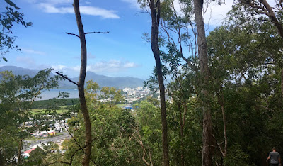 |
| The city seen from the "red arrow" |
 |
| From the ground level - looking towards The Pier shopping centre. |
The shoreline (The Esplanade) with playgrounds and sports facilities:
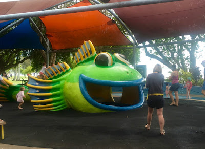 |
| One of the playgrounds on Esplanade |
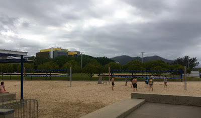 |
| Beach volleyball courts and the hospital on Esplanade |
 |
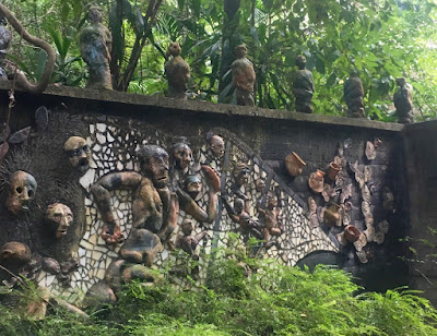
| Art installation near the wharf |
 |
| I think I saw these metal rocks at the Swell Festival in Gold Coast |
The Tanks Arts Centre, the Botanical Gardens, the Rainforest Boardwalk, the Butterfly Garden, the Esplanade:
 |
| Near the entrance to the Tanks Arts Centre. The tanks were used during WW2 to store oil. |
 |
| Art gallery in tank 4 |
 |
| Butterfly garden |
 |
| Butterflies |
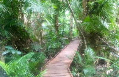 |
Rainforest Boardwalk
|
There are a few historical buildings in Cairns.
 |
| RSL (Returned and Services League) club |
 |
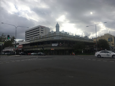
| The Boland Centre, built in 1913 |
 |
Airport - top left, Tanks Arts Centre, Botanical Gardens and Mt Whitfield below.
The Rainforest Boardwalk to the right of Botanical Gardens.
Top: Esplanade and the wharfs on the right. |
Second,
the bad.
Primarily the
design of the city: it was designed for cars, not people. The streets are too wide, the sidewalks in the CBD too narrow. It is easy to park, it is hard to walk or ride a bicycle. Walk 150 meters, come to a red light, press a button, wait for a couple of minutes to cross the street, walk 150 meters, come to a red light... There are no shortcuts for pedestrians, no little parks, very few trees. There are a few historical buildings, but it is hard to spot and appreciate them in the sea of cars.
Also, the
neglect and
mishmash of buildings.
And the
noise: of helicopters landing near one end of Esplanade and planes taking off near the other end, of cars at parts of the red and blue arrow walking tracks (Captain Hook Highway) and everywhere else in the city.
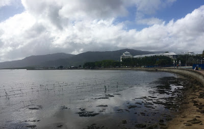 |
Trinity inlet at low tide provides an opportunity to see mudskippers, but doesn't look pretty.
|
 |
| Promenade or esplanade? Trying to confuse tourists? |
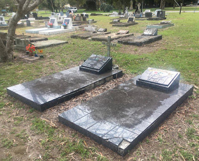 |
| Most graves in the city cemetery are neglected. |
 |
Too wide streets - same problem as in Mackay.
These streets were designed maybe 100 years ago,
and are wide enough for an avenue of an imperial capital.
Today Cairns is 52 km long north-south and has a population of 157 thousand people.
This street is in the centre of the city. |
 |
Neglected old houses.
This one looks abandoned, but there are others in not much better shape with people living in them.
Oh, and this is off Esplanade. |
 |
| Former Telegraph Office barely visible because of cars. |
 |
| The Central Hotel, built in 1909 - it would be nice if this was a pedestrian plaza, not a sea of asphalt. |
 |
| A Peace Park plaque that could use some loving care. |
 |
|
- please maintain it, these are beautiful ideas worth promoting.
|
 |
| Mishmash of new and old off Esplanade |
 |
| The first tank you see of the Tanks Arts Centre - I thought that was it until I found the other tanks. |
 |
| No people, no business, concrete ugly sidewalk, and the street so wide, the other side barely fits in the camera. |
In Mackay I saw a city beautification project in progress. In Cairns I saw nothing like that. From that short trip I got an impression that Cairns is primarily a base for reef and national park trips, and not a destination in itself.


Wide streets are advantage, not the drawback.
ReplyDelete